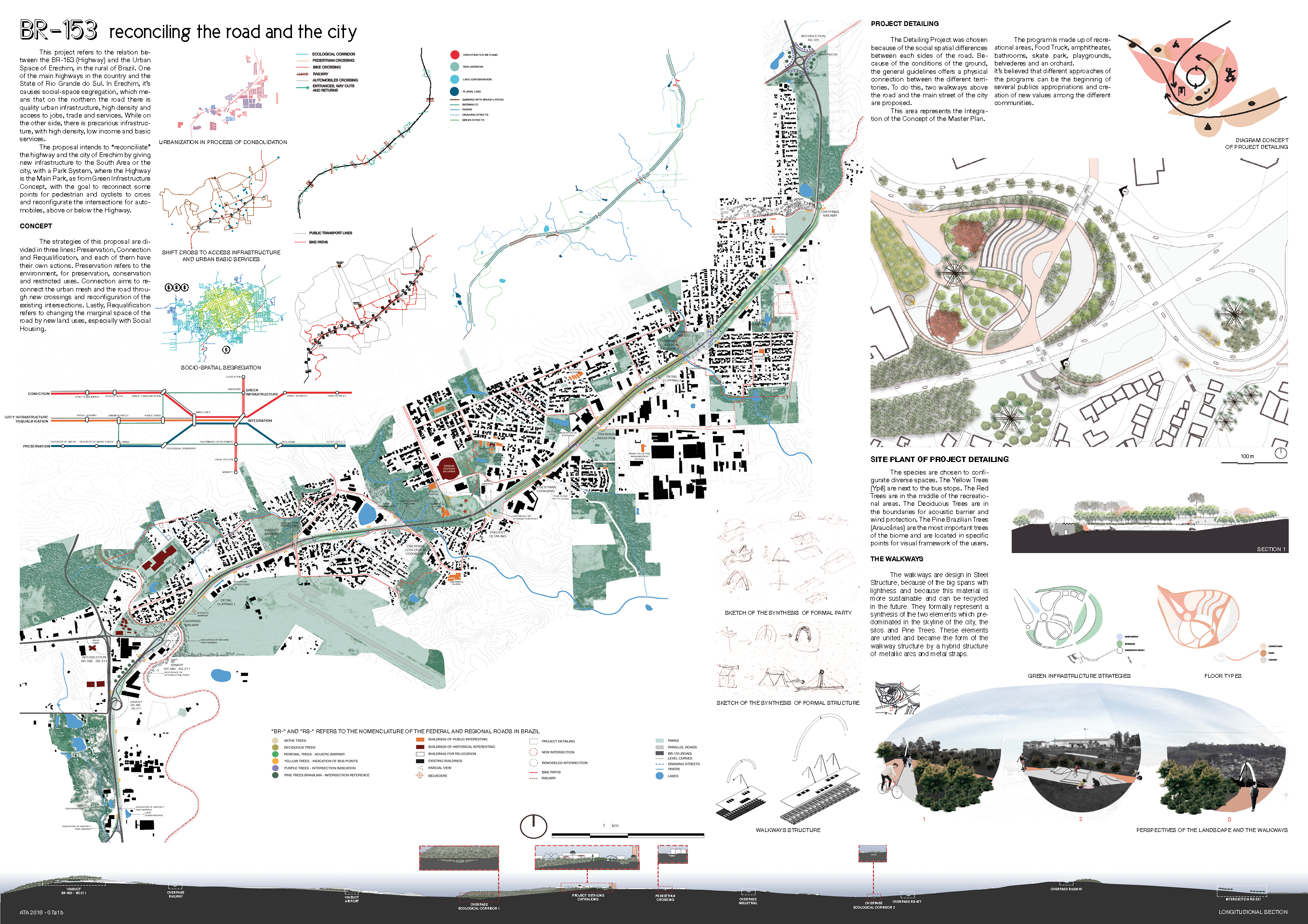
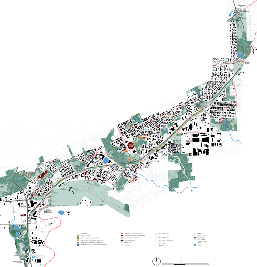
This project refers to the relation between the BR-153 (Highway) and the Urban Space of Erechim, in the rural of Brazil. One of the main highways in the country and the State of Rio Grande do Sul. In Erechim, it’s causes social-space segregation, which means that on the northern the road there is quality urban infrastructure, high density and access to jobs, trade and services. While on the other side, there is precarious infrastructure, with high density, low income and basic services.
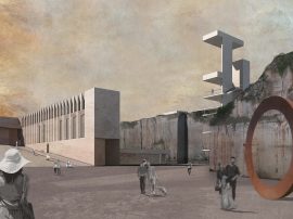
The proposal intends to “reconciliate” the highway and the city of Erechim by giving new infrastructure to the South Area or the city, with a Park System, where the Highway is the Main Park, as from Green Infrastructure Concept.
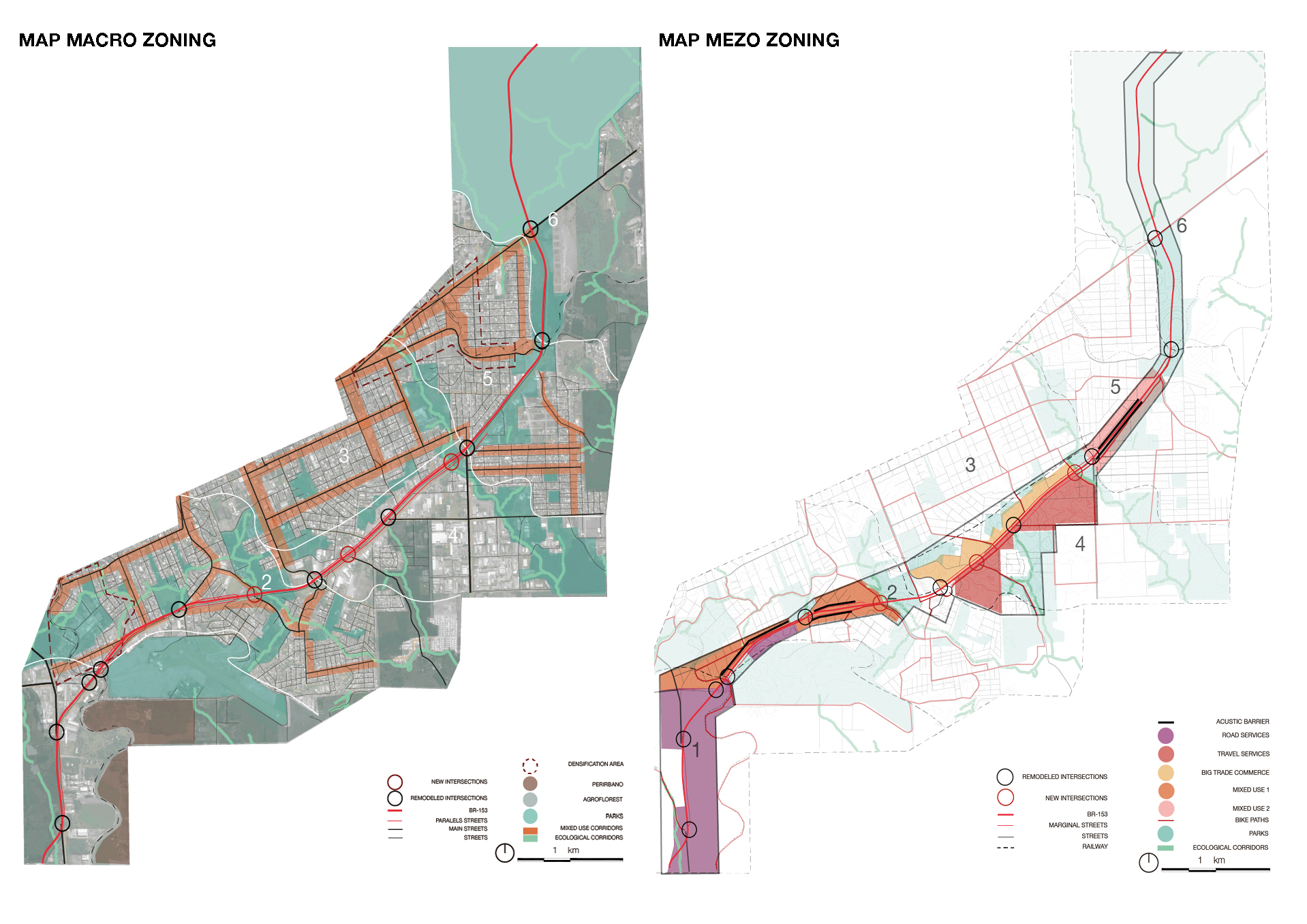
Macro Zoning - Parks: defined by free areas, squares and fragments of native forest. Besides, areas with environment fragility and Scenic Aspects. Mixed Corridors: streets with bike paths, public transportation and mixed used buildings of medium density up to 4 floors. Ecological Corridors: are together the line of draining where are the urban rivers. The are functional for receive public spaces with low impact and connecting the Park System. There still are an ecological circuit and transitions for development of the Fauna and Flora. Agroforestry Use: areas that aim to recover the Native Forest with a Productive Forest and support of population in need. Peri-urban Use: for the food production and animal husbandry. This are the transitions between rural and urban area. Mezo Zoning - Mixed Use 1: residential area of middle density, with buildings up to four floors, with part destination of the Social Housing for relocation of the irregular occupation areas. Mixed Use 2?: residential area of high density, with buildings up to six floors, with part destination of the Social Housing for relocation of the irregular occupation areas. Travel Services: used land of mix edifications with bars, restaurants, hotel and B & B’s for the support of a new economy. Road Services: destination of road services such as mechanics, rubber services, felling stations. Big Trade Services: destination for the commerce of automobiles and agricultural inputs.
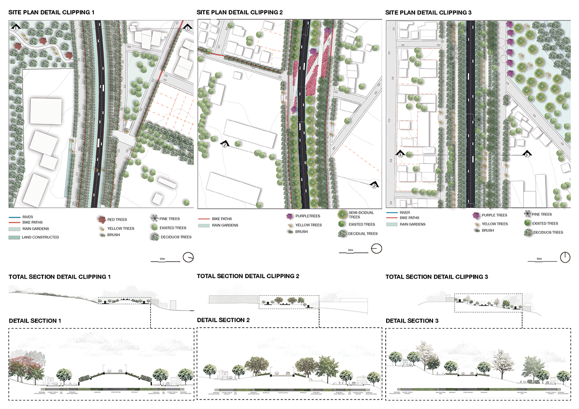
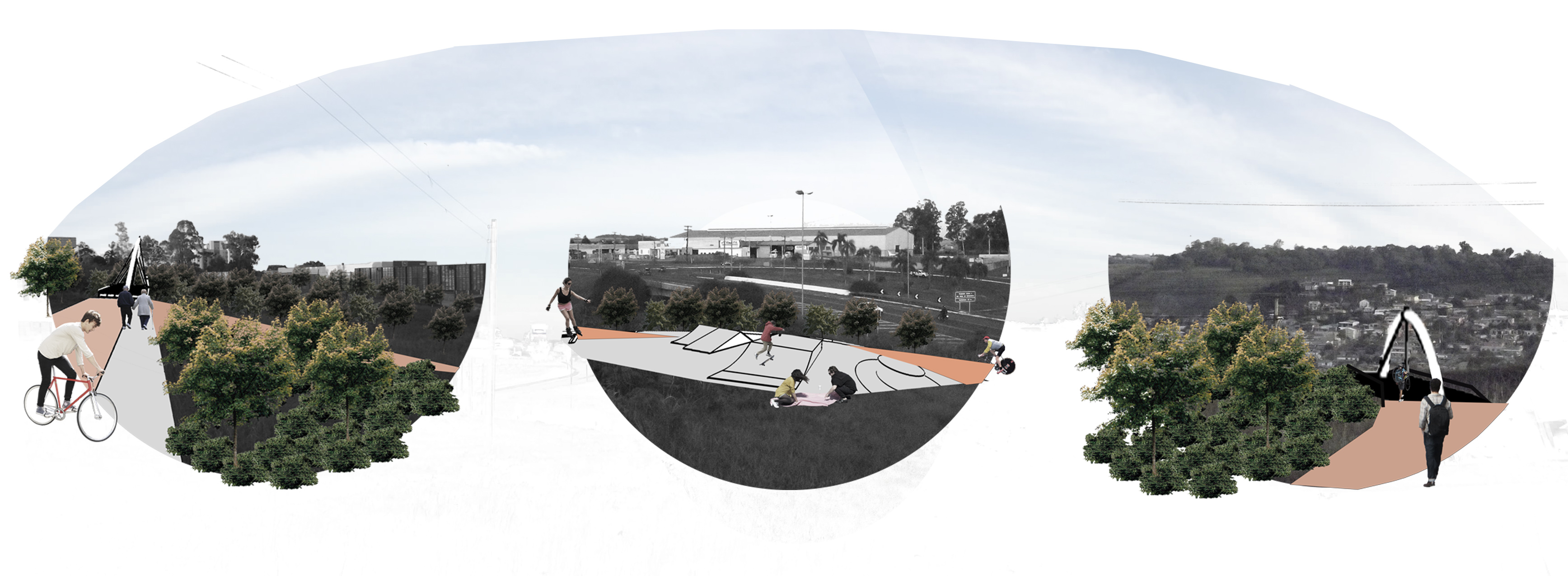
Detail Clipping 1 - Are localized between the Land Use of Mixed Use 1 and the Airport Park and Road Services. In this stretch the road is above the marginal sides of the urban area. The height of the adjacent buildings is 15 m for preservation of the Skyline City View. The vegetation here is functional of the barriers acoustic with acoustic protection plates for reduction of the noise. Detail Clipping 2 - Are located between the Land Use is Big Trade Commerce and Travel Services. In this stretch the road is parallel with the marginal sides of the urban area and are the biggest Park Area. In this point of the road the access is limited with protective barriers for safety of the people in the Park Area. Detail Clipping 3 - In this point the Land Use is Mixed Use 2. In this stretch the road is stepped of the marginal sides of the urban area. The vegetation here is functional of the barriers acoustic and have acoustic protection plates for reduction of the noise. The edge of the Park the public use with playgrounds, shared rides and recreation areas.
The Board: